|
>How to Connect to ArcGIS Pro< |
|
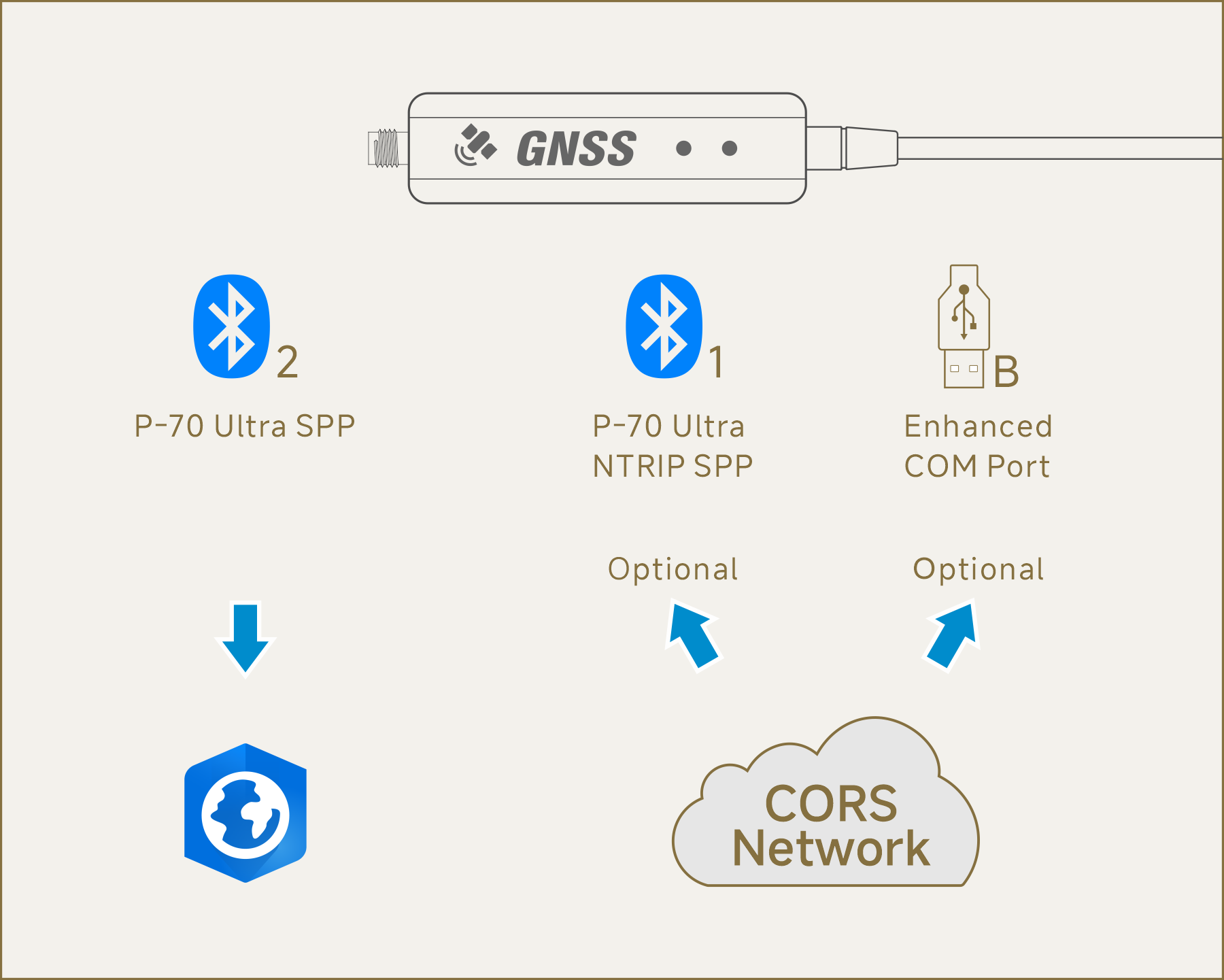
Since ArcGIS Pro does not support USB/serial devices with a baud rate of 230,400
bps, it is necessary to use Bluetooth for connection.
Additionally, ArcGIS Pro does not support providing NTRIP data to the P-70
Ultra. It is recommended to use another app to connect to an NTRIP service
(optional) to achieve centimeter-level positioning accuracy. For more
information, please refer to>
Steps: |
|
Using "Windows" as an example: |
|
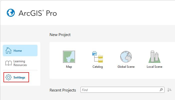
 Run "ArcGIS Pro", go to the
Home page, and click "Settings". Run "ArcGIS Pro", go to the
Home page, and click "Settings". |
|
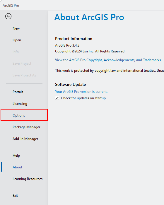
 Click "Options". Click "Options". |
|
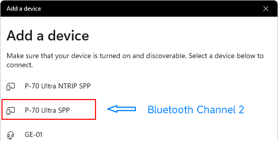
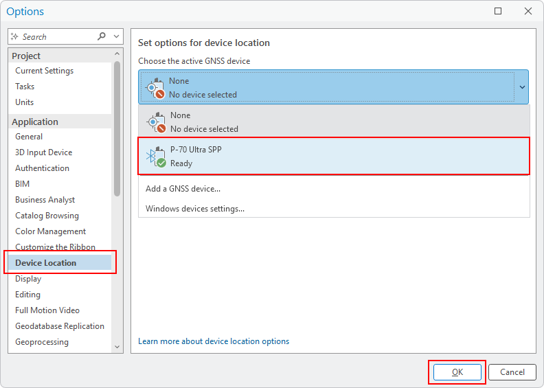
Click "Device
Location", then select "P-70 Ultra SPP" under "Choose the active GNSS device". |
|
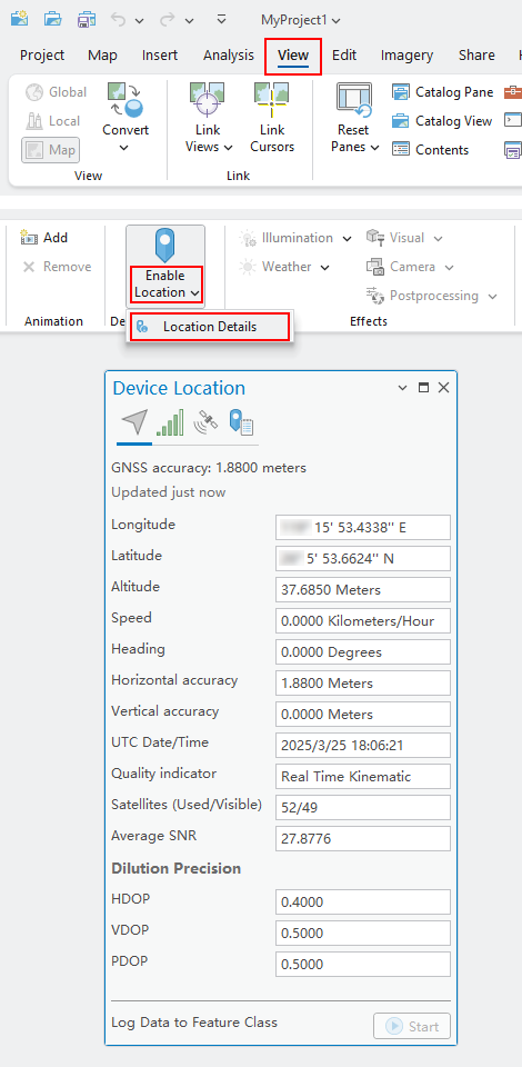
Click "View",
then go to "Enable Location" - "Location Details". When positioning information
appears, it indicates a successful connection, and the Bluetooth Lamp on the
P-70 Ultra will light up. |
|
|